

by Lex Celera
Making your way to the city through mass transit gets easier with routine, but the first time almost always gets you in a daze. Our country has admittedly the worst traffic and road management. that we need all these various modes of mass transportation just to take us your places; case in point, jeeps, tricycles, and the UV Express. But now things are getting easier. If Waze got your back during driving, Sakay.ph is there for your commute.
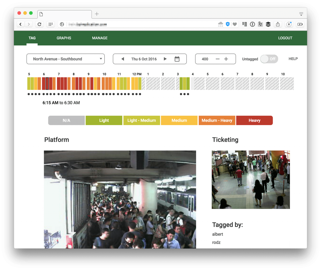
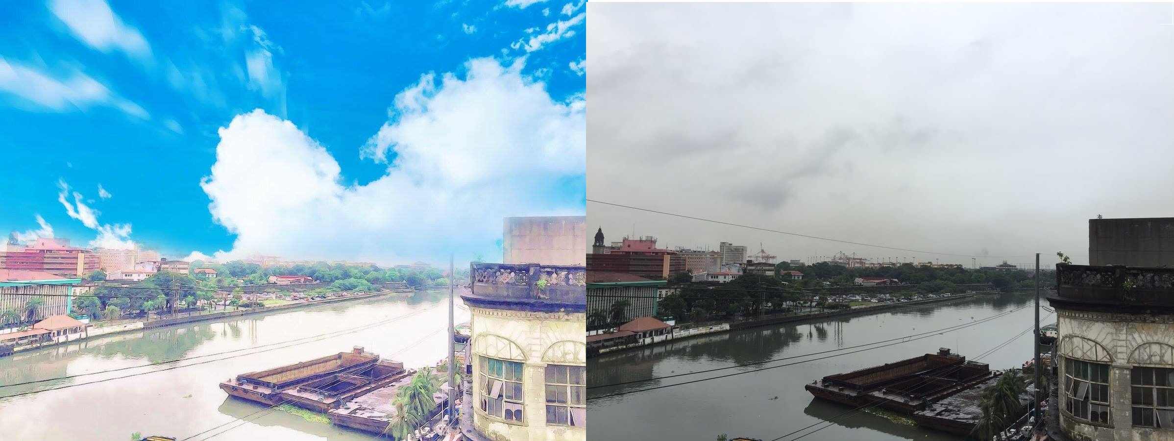
A look at the internal tool Sakay.ph uses for Traincheck
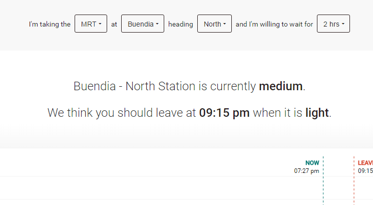
First helping you with getting you to places through all the vehicles you can ride on the road in Manila, how else can you improve by helping people with the biggest mode of transportation of land we have–trains? “Traincheck™ is a project by Sakay.ph that shows you the perfect time to take the MRT,” the description on their site says. “We predict when train stations are going to be crowded, so you can avoid lines and crowds. It’s also a part of our main app, Sakay.ph!”
We talked to Philip Cheang and Kenneth Yu, co-founders of Sakay.ph, about what Sakay.ph and Traincheck are all about:
First off, what is Sakay.ph all about?
Sakay.ph is an app that gives free transit directions to and from anywhere in Metro Manila. We’re like Waze, but for commuting. Our database covers jeeps, buses, trains, P2P buses, shuttles, and more coming soon, like UV Express!
Our goal is to help people find their way throughout the Philippines, in the best and fastest possible way. To this end, we have incident reports, traffic modeling, offline saving, and congestion prediction to improve the quality of our directions.
We have apps for iPhone and Android, and a web app. Users can also have directions printed out.
Traincheck (traincheck.sakay.ph) is our newest feature. It tells users the best time to use the MRT, by predicting when stations will be crowded. These predictions are also now integrated with the main Sakay.ph app.
What other features are you considering to add for Sakay.ph?
We have a lot of features on our roadmap. Here are a few:
— We want to add landmarks at corners and along streets, so people get directions like “turn right at the corner with the Jollibee, and keep going until you see FamilyMart”, in addition to the usual street names. (This is similar to how people give directions in real life, and we don’t know of any other app that does this.)
— We’ve also collected data for UV Express routes, and will be integrating them into our app very soon.
— Finally, we will be showing real-time GPS positions of buses on our maps, and providing estimated times of arrivals with our directions.
There are even more features planned, but we can’t talk about them right now. But the three ones we talked about are already pretty big!
Have you considered adding a map on where in the station to line up? I know some spots in the train are just lighter regardless of the time period.
This is something we can look at! We may consider crowdsourcing this data, and allowing users to report it, much like they do with errors and incidents. Thank you!
Truth be told, the web page still has a bit of bugs to fix, but it’s cool that we’re finally getting a tool that will help us navigate Manila the cheapest way we could–through the commute.
Try it out here.


Comments